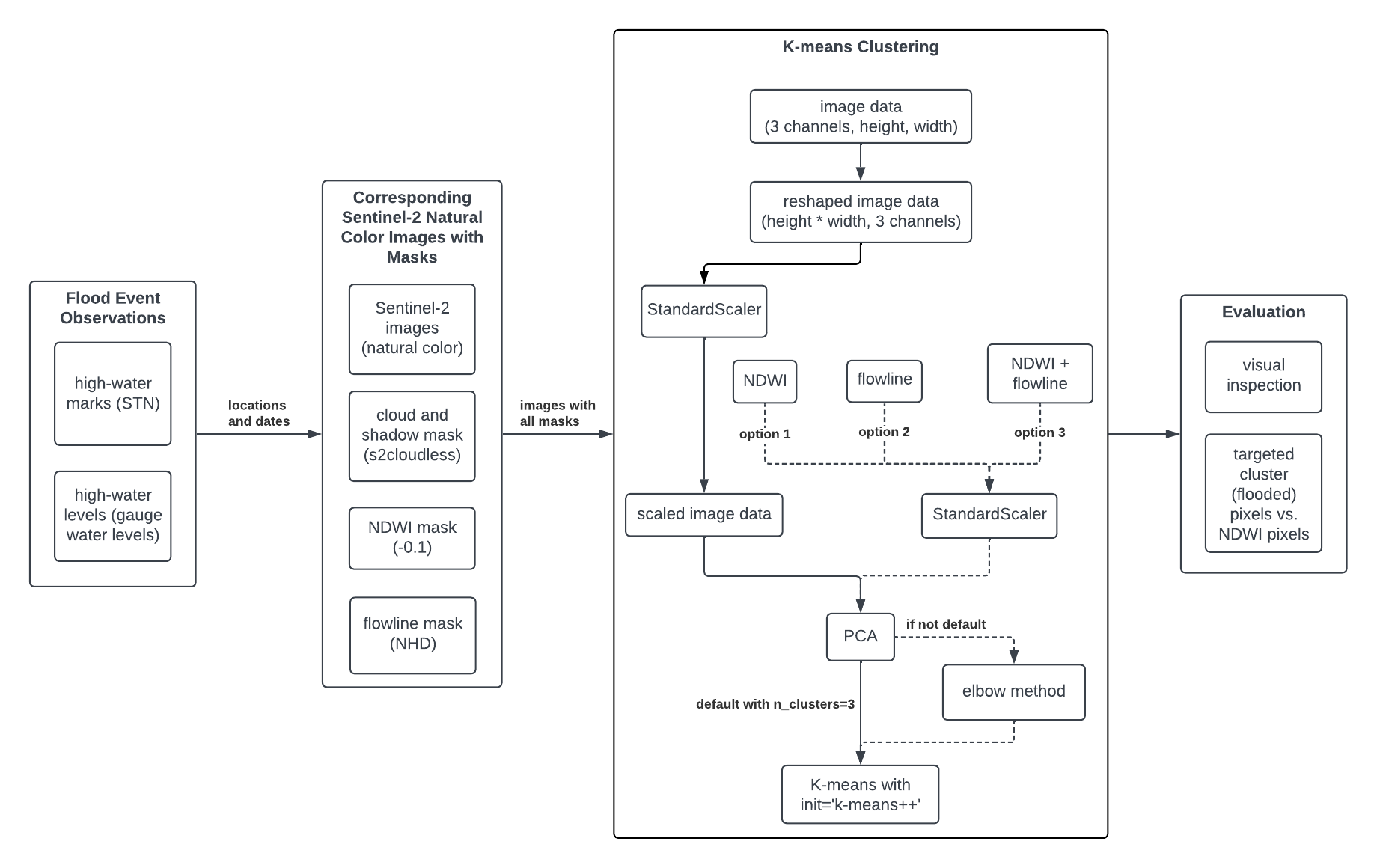
Data and Workflow Documentation
Data
| Name | Source | Description | Format | Links |
|---|---|---|---|---|
| High-water marks | STN flood event data | Validated flood event observations from USGS | CSV | Report Guide Data |
| High-water levels | USGS Water Data Services | Real-time gauge water levels above moderate flood stage | CSV | Report Guide Data |
| Sentinel-2 images | Sentinel-2 Level-2A | Satellite images corresponding to the areas of interests and timeframes defined by high-water marks and levels | GeoTIFF | Report Guide Data |
| Cloud and Shadow masks | s2cloudless | Cloud and shadow pixels to be removed | GeoTIFF | Report Guide Data |
| NDWI masks | NDWI tutorial | Water body pixels defined by Normalized Difference Water Index | GeoTIFF | Report Guide Data |
| Flowlines masks | National Hydrography Dataset | Routes that make up a linear surface water drainage network | Shapefile | Report Guide Data |
Workflow